Isla Cuale Puerto Vallarta
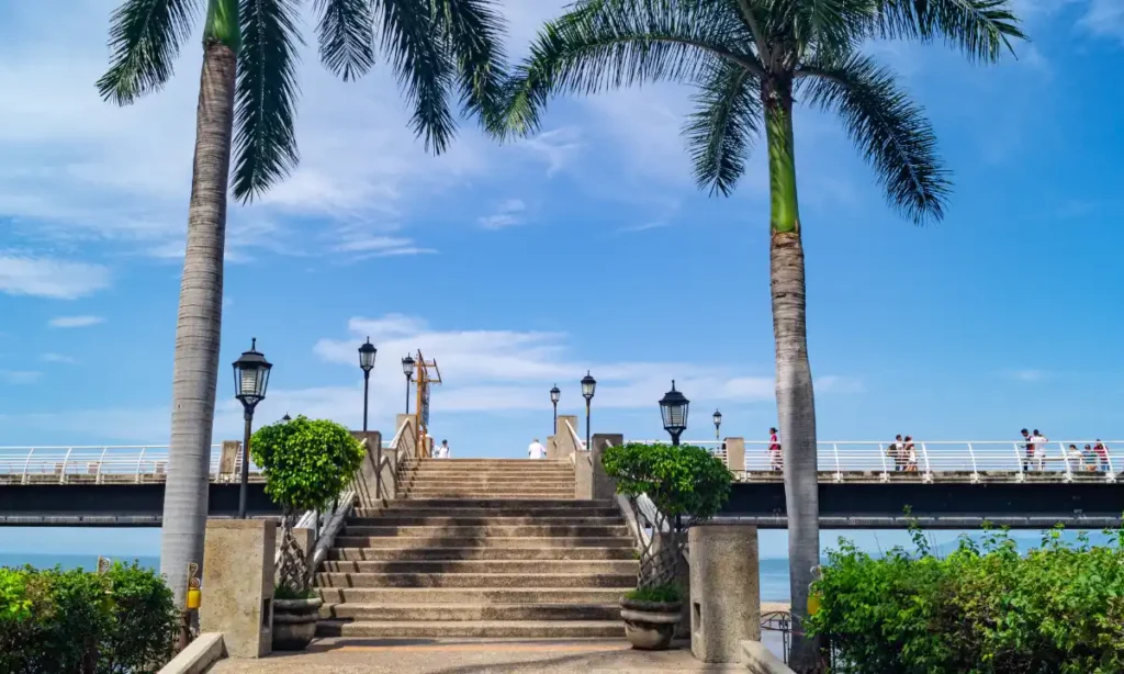
Downtown Puerto Vallarta can feel overwhelming when your time is limited and every block seems to offer something different. Many visitors wonder if Isla Cuale is worth stopping for when they only have a short window between other plans, cruise schedules, or tour departures. The island offers a calm break from busy streets, giving you shade, local culture, and river views without needing transportation or planning. In just two hours, you can walk its paths, browse local crafts, and reset before heading to your next day trip in Puerto Vallarta. You will get a realistic, walkable outline that helps you decide what to see, what to skip, and how to use your time well. What Is Isla Cuale and Why It’s Unique in Puerto Vallarta Isla Cuale is a small river island formed by the Cuale River, sitting between downtown Puerto Vallarta and the Old Town area. Unlike beaches or ocean viewpoints, the island is surrounded by fresh water, trees, and shaded walkways, creating a cooler and quieter setting. Historically, the area has served as a community space, hosting cultural events, local markets, and a museum that reflects regional art and history. This background gives Isla Cuale a local feel that differs from the tourist-heavy Malecón nearby. There is no traffic noise, no beach vendors, and no pressure to rush. Instead, visitors find a slower pace that highlights everyday life, crafts, and simple views of the river flowing toward the sea, making it a distinct stop within the city. Where Isla Cuale Is Located and How to Get There Easily Isla Cuale is located directly along the Cuale River, which runs through the center of Puerto Vallarta before reaching the ocean. The island is connected by pedestrian bridges, making it easy to reach on foot from multiple directions. From the Malecón, visitors can cross one of the bridges near downtown shops in just a few minutes. From Zona Romántica, another bridge provides direct access without needing to cross busy streets. These bridges are flat and well maintained, allowing smooth entry for most visitors. For those with limited mobility, the main paths are paved and relatively even, though some areas may feel narrow. Because the island sits between major neighborhoods, it fits naturally into a walking route without extra planning. How to Spend 2 Hours on Isla Cuale: A Simple Time-Based Plan Time Slot Activity What You’ll Experience Why It Works First 30 Minutes Walk island paths & bridges Shaded walkways, river views, calm atmosphere Helps you adjust from busy streets Next 45 Minutes Artisan market browsing Handmade crafts, local vendors, relaxed shopping Best use of peak vendor hours Next 30 Minutes Museum or river rest Cultural insight or quiet seating Prevents fatigue Final 15 Minutes Coffee or scenic exit Short break before next stop Smooth transition to next activity First 30 Minutes: Crossing the Bridges and Exploring the Island Paths The first thing most visitors notice when stepping onto Isla Cuale is the change in atmosphere. Street noise fades, and the sound of moving water and birds becomes more noticeable. Shaded walkways lined with trees make walking comfortable even on warmer days. River views appear at different points along the paths, offering short stops for photos or quiet observation. This is not a place to rush through. Walking slowly allows you to notice small details, such as local art displays and community spaces tucked along the paths. Taking your time here sets the tone for the rest of the visit and helps you enjoy the island as a pause rather than just another attraction to check off. Next 45 Minutes: Local Artisan Market and Handcrafted Souvenirs The artisan market is one of the main reasons people visit Isla Cuale, and it works well within a short visit. Vendors sell silver jewelry, woven textiles, wood carvings, and small decorative items made by local craftspeople. Compared to street stalls along the Malecón, items here often show more handwork and traditional designs. Prices vary, and polite bargaining is common, especially for higher-priced pieces. A simple approach is to ask questions about materials and origin before discussing cost. Mass-produced souvenirs tend to look identical and overly polished, while handmade items show slight variations. Spending time here allows you to support local artists and find meaningful keepsakes without feeling pressured by heavy foot traffic. Next 30 Minutes: Cultural Museum or Riverside Rest Spots After shopping, many visitors choose between visiting the small cultural museum or relaxing along the river. The museum focuses on regional art and rotating exhibits, offering insight into local history and creative expression. It is worth visiting if you enjoy quiet indoor spaces and cultural context. If museums are not your interest, the riverside benches and shaded corners provide a peaceful alternative. These spots are ideal for resting, people-watching, or simply enjoying the breeze coming off the water. This part of the visit often becomes a favorite for travelers who want a break from constant movement. Choosing between the museum and rest areas depends on energy levels and personal interests, not on what feels expected. Final 15 Minutes: Coffee, Snacks, or Scenic Exit Toward Old Town The final part of a two-hour visit works best when kept simple. Small cafés and snack vendors near the exits offer quick options for coffee, cold drinks, or light bites. This is a good moment to decide your next direction. Exiting toward Old Town leads you closer to restaurants and beach access, while returning toward the Malecón places you back near shops and waterfront walks. Taking a few minutes to enjoy a drink or snack helps transition from the calm island setting back into the busier city. Planning this exit in advance prevents backtracking and keeps the overall visit smooth, especially if you are heading to another scheduled activity. Shopping on Isla Cuale: What’s Worth Buying and What to Skip Shopping on Isla Cuale is best approached with a focus on quality rather than quantity. Common items include silver jewelry, hand-woven bags, embroidered clothing, and
Chimo Village by Boat
Chimo is often described as one of the most remote excursions you can take from Puerto Vallarta, but what does that actually mean? Unlike popular stops such as Yelapa or Las Ánimas, Chimo is a small fishing village located well south of Banderas Bay, in a stretch of coastline that feels noticeably less developed. There are no highways leading there, no large resorts, and no cruise ship crowds. The only practical way to reach Chimo is by boat, which immediately changes the type of traveler who makes the journey. You’ll learn how long the ride actually takes, what sea conditions can feel like beyond the protection of the bay, what activities are available once you arrive, and who this excursion is best suited for. Chimo is not a casual beach stop, it’s a commitment. Understanding that difference is essential before you plan the trip. Where Is Chimo Village and How Do You Get There? Chimo is located south of Yelapa in the municipality of Cabo Corrientes, along a rugged section of the Pacific coastline. Unlike Boca de Tomatlán or even Yelapa, there is no road connecting Chimo to Puerto Vallarta. The Sierra Madre mountains meet the ocean here, cutting off vehicle access entirely. As a result, all visitors arrive by boat. From Marina Vallarta or the Hotel Zone, travel time typically ranges between 1.5 and 2 hours, depending on vessel speed and sea conditions. The route moves beyond the relatively protected waters of central Banderas Bay and into more open Pacific waters. This matters because wind patterns often shift in the afternoon, creating choppier conditions on the return trip. Access Overview Departure Point Approx. Travel Time Road Access Sea Exposure Level Marina Vallarta 1.5–2 hours None Moderate–High Boca de Tomatlán 1–1.5 hours None Moderate Morning departures are generally smoother, especially outside of peak storm season. Planning around weather and wind patterns significantly affects comfort. What Is Chimo Actually Like? Chimo is first and foremost a working fishing village. With a small year-round population, daily life revolves around the ocean rather than tourism. Visitors arriving for the first time often notice how quiet it feels compared to other coastal stops near Puerto Vallarta. There are no beach clubs, no organized entertainment, and no developed promenade. The shoreline is rocky in many areas, with a small stretch of beach near the village center. Fishing boats line the water, and the rhythm of the day depends on tides and catch schedules. Most businesses operate informally, and cash is essential since there are no ATMs. Cell service can be inconsistent. Dining options are limited to small family-run restaurants offering fresh seafood, typically based on what was caught that day. This simplicity is part of Chimo’s appeal, but it also means visitors should not expect resort-style amenities or structured activities. What Can You Do in Chimo? Chimo’s appeal lies in its natural setting rather than built attractions. Activities here are centered around the water and surrounding marine environment. Scuba Diving & Deep Water Sites Chimo is known among experienced divers for offshore deep-water sites and underwater canyons. The ocean floor drops off more dramatically in this southern region, attracting pelagic species at certain times of year. These sites are generally suited for certified, experienced divers due to depth profiles and potential currents. Visibility tends to be best during summer months when plankton levels decrease. Sport Fishing Because of its proximity to deeper waters, Chimo is a prime departure point for those looking to rent a boat to go fishing in Puerto Vallarta. Fishing conditions vary by month, and experienced captains typically monitor water temperatures and migratory patterns. This region is considered more productive for offshore fishing than central bay areas. Snorkeling & Coastal Exploration While the village is quiet, the surrounding rocky reefs provide excellent opportunities for underwater discovery. If you are looking for a private boat in Puerto Vallarta to explore these hidden coves, Chimo offers a level of isolation you won’t find at more crowded sites like Los Arcos. Marine life may include reef fish, rays, and seasonal visitors. Conditions depend heavily on swell and wind, so calm mornings are preferred. Village Walk & Local Dining A short walk through the village offers insight into daily coastal life. Small restaurants serve fresh seafood dishes such as grilled fish, ceviche, and shrimp prepared simply. Menus are limited, and availability depends on local supply. There are no nightlife venues or structured tours within the village itself, reinforcing its quiet atmosphere. How Long Does It Take to Reach Chimo? Reaching Chimo requires time and planning. From Marina Vallarta, the ride typically takes between 1.5 and 2 hours. The journey moves progressively farther from the protection of Banderas Bay and into open Pacific waters, where wave patterns can be more pronounced. Morning departures are strongly recommended. Wind speeds along this coastline often increase in the afternoon, particularly during warmer months, leading to choppier return conditions. The longer travel distance also means that fuel planning, hydration, and sun exposure should be considered carefully. Travelers prone to motion sensitivity should be aware that open-water conditions can feel different from shorter coastal rides to destinations like Las Ánimas. Factoring in total travel time, both outbound and return, is important when evaluating whether this excursion aligns with your comfort level. Best Time of Year to Visit Chimo Seasonality plays a major role in the Chimo experience. During summer months (typically June through September), offshore waters often appear clearer in the mornings, which can benefit diving and snorkeling visibility. However, this period also overlaps with Mexico’s rainy season, when afternoon storms and higher humidity are common. Winter months (November through March) bring cooler air temperatures and the humpback whale migration in Banderas Bay. Increased boat traffic in central bay areas does not always extend as far south as Chimo, but open-water swells can still vary depending on weather systems moving across the Pacific. Heat exposure is another consideration. With limited shade infrastructure in the village, midday sun can feel intense. For
Temazcal in Puerto Vallarta
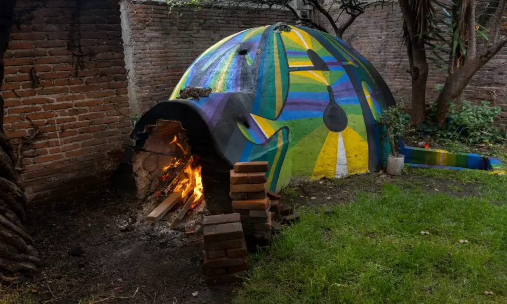
A temazcal is often described as a traditional Mexican sweat lodge ceremony, but reducing it to a sauna experience misses its cultural and spiritual depth. Rooted in Indigenous Mesoamerican traditions, the temazcal combines heat, ritual, and guided intention inside a small dome-shaped structure made of stone, clay, or adobe. In Puerto Vallarta and the surrounding Sierra Madre region, temazcal ceremonies are commonly offered in jungle settings where natural surroundings enhance the immersive atmosphere. Unlike a hotel steam room, a temazcal is typically guided by a trained facilitator and may include chanting, herbal infusions, and structured stages of reflection. Puerto Vallarta’s tropical climate and proximity to nature make it a fitting environment for this practice, especially when combined with a Puerto Vallarta jungle tour to reach eco-retreats outside the urban center. The Origins of Temazcal: Indigenous Tradition Explained The word temazcal comes from the Nahuatl term temazcalli, meaning house of heat. Nahuatl was the language of the Mexica (Aztec) civilization, one of the major cultures of pre-Hispanic Mesoamerica. Historical sources from colonial-era codices and anthropological research indicate that sweat lodges were used by Indigenous communities throughout central and western Mexico for purification, healing, and ceremonial preparation. In pre-Hispanic societies, temazcal ceremonies were associated with physical cleansing, spiritual renewal, and preparation for important life transitions such as childbirth or warfare. Archaeological evidence of sweat lodge structures has been found in multiple regions of Mexico, including areas influenced by Aztec and Maya cultures. Modern temazcal ceremonies in Puerto Vallarta are adaptations of these ancient practices, often blending traditional symbolism with contemporary wellness elements. Today, temazcal experiences may vary in intensity and structure. Some ceremonies maintain Indigenous spiritual elements, while others focus primarily on relaxation and detoxification themes. Understanding this historical foundation helps visitors approach the experience with respect and realistic expectations. What Actually Happens During a Temazcal Ceremony? A traditional temazcal ceremony takes place inside a small, dome-shaped structure representing the womb of the earth. The ceremony is typically guided by a temazcalero or temazcalera (ceremony leader), who manages the ritual sequence and safety oversight. Step-by-Step Overview Entering the Dome Participants enter on hands and knees, symbolizing humility and rebirth. The space is dark, enclosed, and often accommodates small groups. Heated Volcanic Stones Stones are heated outside in a fire until extremely hot, then placed into a central pit inside the dome. Water infused with herbs is poured over the stones to create steam. Herbal Infusions Common herbs may include eucalyptus, rosemary, or copal resin, depending on the facilitator. These infusions increase steam intensity and aroma. Chanting and Guided Ritual The ceremony may include guided breathing, traditional songs, or moments of reflection. Some facilitators incorporate Indigenous cosmology and symbolic storytelling. Four Doors or Stages Many ceremonies are divided into four rounds, often called doors, each representing elements such as earth, water, fire, and air. Heat intensity typically increases with each stage. Duration and Physical Intensity A full ceremony generally lasts between 1.5 and 3 hours. Heat levels can be intense, and participants sweat heavily. Breaks may be offered between stages, but the enclosed environment can feel challenging for those sensitive to heat. While often described as cleansing, the experience is physically demanding and should not be approached casually. How Is Temazcal Different from a Sauna or Steam Room? Although both involve heat and sweating, a temazcal differs significantly from a conventional sauna or steam bath found in spas. Feature Temazcal Sauna Cultural Ceremony Yes No Guided Ritual Yes No Spiritual Element Often No Heat Source Volcanic stones Electric/Wood Structure Dome clay/stone Wood room A sauna typically focuses on relaxation and muscle recovery, while a temazcal integrates cultural symbolism, ritual guidance, and structured stages. The dome’s shape, darkness, and communal setting create a very different psychological and physical experience compared to a standard spa facility. Is Temazcal Safe? Who Should Avoid It? Because temazcal ceremonies involve prolonged heat exposure, safety considerations are important. Individuals with heart conditions, uncontrolled high blood pressure, respiratory disorders, or a history of heat intolerance should consult a medical professional before participating. Pregnant individuals are generally advised to avoid intense heat environments. Severe claustrophobia can also make the enclosed dome structure uncomfortable. Hydration is critical before and after the ceremony. Participants are usually encouraged to drink water in advance and avoid heavy meals or alcohol beforehand. Professional facilitation is essential, as experienced leaders monitor group conditions and manage heat intensity. While many people complete ceremonies safely, it is not a passive spa treatment. Awareness of physical limits is important for a positive experience. Types of Temazcal Experiences in Puerto Vallarta Temazcal offerings in the Puerto Vallarta region vary widely in style and setting. Traditional Indigenous-Led Ceremonies These experiences are often held in rural or jungle locations and led by facilitators trained in ancestral practices. Ritual symbolism and spiritual elements are typically emphasized. Retreat Center Experiences Eco-retreats in the Sierra Madre foothills, such as wellness lodges accessible by boat or jungle road, incorporate temazcal into broader yoga or mindfulness programs. These tend to blend tradition with structured retreat programming. Hotel Spa-Style Temazcal Some resorts and spa facilities offer shorter, less intense versions focused primarily on relaxation rather than ritual. These may feel more like wellness treatments than ceremonial events. Private Group Ceremony Small private sessions can be arranged for families or groups, often paired with the luxury of a luxury yacht fleet for transportation to the ceremony site. Jungle Eco-Center Settings Outdoor ecological centers combine temazcal with natural surroundings, sometimes pairing the ceremony with river swims or forest immersion experiences. Understanding these differences helps visitors choose between a culturally immersive ceremony and a more comfort-oriented wellness experience. How Much Does a Temazcal in Puerto Vallarta Cost? Pricing for a temazcal in Puerto Vallarta varies depending on location, group size, and whether the ceremony is part of a larger wellness retreat. Costs typically reflect facilitator experience, transportation logistics, and whether additional elements such as herbal teas, fruit, or post-ceremony relaxation areas are included. In general, a group ceremony in the Puerto
Scuba Diving in Puerto Vallarta
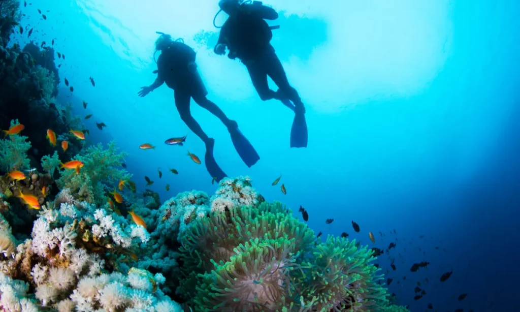
Puerto Vallarta offers Pacific-style diving, which differs significantly from Caribbean reef systems. Divers expecting year-round, crystal-clear, 30-meter visibility like Cozumel may be surprised. Banderas Bay diving is more seasonal, influenced by plankton cycles, offshore currents, and water temperature shifts. Visibility can range from 5–8 meters in cooler winter months to 20–30 meters during peak summer conditions, particularly from June through October. The Pacific ecosystem also means larger rock formations, volcanic pinnacles, and pelagic encounters rather than extensive coral reefs. You’re more likely to see rays, turtles, moray eels, and seasonal shark species than wide coral gardens. Setting realistic expectations helps divers choose the right time and site based on certification level and comfort in variable conditions. Where Do You Dive in Puerto Vallarta? Most dive operations depart from Marina Vallarta or the southern marina near Los Muertos Pier. Travel times vary depending on site distance and sea conditions. Los Arcos Marine Park Located south of Puerto Vallarta near Mismaloya, Los Arcos is typically 30–45 minutes by boat from Marina Vallarta. It is one of the most accessible and frequently visited dive areas in Banderas Bay. Marietas Islands Situated northwest toward Punta Mita, the Marietas Islands require approximately 60–90 minutes of travel time depending on departure point and weather. Sea conditions can influence travel duration. El Morro El Morro lies offshore in deeper Pacific waters and often requires a longer ride, sometimes over an hour from Marina Vallarta. Conditions here are more exposed compared to in-bay sites. Majahuitas Majahuitas is located south of Los Arcos and generally takes about 45 minutes to reach. It is known for calmer conditions relative to offshore pinnacles. Punta Mita Area Dive spots near Punta Mita sit outside the main curve of Banderas Bay and may involve stronger currents. Travel time ranges between 60–90 minutes depending on specific reef or pinnacle location. Boat duration matters when planning surface intervals and weather windows, especially during months with afternoon wind shifts. Quick Comparison of Best Dive Sites in Puerto Vallarta Below is a simplified comparison of major dive zones to help match skill level and seasonal timing. Dive Site Skill Level Depth Range Visibility Best Months Currents Marine Life Highlights Los Arcos Beginner–Advanced 8–25m Jun–Oct Mild–Moderate Turtles, rays Marietas Intermediate 10–30m Jul–Oct Moderate Reef fish, caves El Morro Advanced 18–45m Jul–Oct Strong Sharks, pelagics Majahuitas Beginner 6–18m Jun–Sept Mild Reef fish Visibility varies annually based on water temperature and plankton density, but summer consistently provides the clearest conditions across most sites. Los Arcos Marine Park: Best for Mixed-Level Divers Los Arcos Marine Park features dramatic granite boulders, underwater arches, and swim-through tunnels formed by volcanic activity. Depths range from shallow 8-meter training zones to deeper 25-meter areas suitable for more experienced divers. This depth variability makes it ideal for mixed-level groups. Because it sits inside Banderas Bay, currents are usually manageable compared to offshore pinnacles. Many beginner certification dives and refresher sessions take place here due to the predictable site layout and varied depth contours. Seasonal clarity improves during summer months, often exceeding 15–20 meters. In winter, cooler water temperatures can reduce visibility due to increased plankton activity. Marine life commonly includes turtles, eagle rays, angelfish, and schools of jacks. El Morro & Advanced Sites: For Experienced Divers Only El Morro consists of offshore pinnacles rising sharply from deeper Pacific waters. Depth profiles can extend beyond 30 meters, with some areas approaching 45 meters. Currents are stronger here, and conditions can shift quickly depending on swell and tide patterns. Because of these factors, most operators require Advanced Open Water certification and recent dive experience. Visibility at El Morro improves significantly during the summer season when water temperatures rise and plankton levels decrease. This is also when pelagic sightings become more likely, including reef sharks and large rays. Winter months may bring thermoclines, layers of colder water at depth, which can reduce comfort and clarity. Divers should understand that this is a more exposed, open-water environment compared to in-bay sites. Marietas Islands: Caves, Reefs & Seasonal Conditions The Marietas Islands are part of a federally protected biosphere reserve. Dive access may be regulated, and certain zones require permits due to conservation policies. Conditions here can vary more than inside Banderas Bay because the islands sit closer to open Pacific waters. The underwater landscape includes rocky reefs, cavern-like swim-through areas, and moderate depth profiles between 10 and 30 meters. Currents can be present but are typically manageable for intermediate-level divers. Marine biodiversity is one of the highlights, with reef fish, moray eels, octopus, and seasonal pelagic species. Because of protected status and offshore exposure, calm weather windows are important. Summer months generally provide clearer water and smoother travel conditions. Divers should confirm entry permissions and seasonal marine park guidelines before planning dives in this area. When Is Visibility Best for Scuba Diving in Puerto Vallarta? Visibility in Puerto Vallarta follows a clear seasonal pattern. The best underwater clarity typically occurs between June and October, when warmer surface temperatures reduce nutrient upwelling and plankton concentration. During these months, visibility can range from 15 to 25 meters, especially at offshore sites like El Morro and the Marietas Islands. In contrast, winter months often see visibility drop to 5–12 meters due to increased plankton blooms and cooler water layers. Thermoclines are common from December through March. These are temperature transition layers where divers may suddenly pass from warm surface water into noticeably cooler depths, sometimes experiencing a 3–5°C change within a few meters. Morning dives usually offer the calmest sea conditions and better clarity before afternoon winds increase surface disturbance inside Banderas Bay. Seasonal Visibility & Temperature Overview Season Visibility Range Water Temperature Conditions Jun–Oct 15–25m 28–30°C Warm water, best clarity Nov–Jan 8–15m 24–26°C Mixed clarity, mild thermoclines Feb–May 5–12m 20–24°C Cooler water, stronger thermoclines Understanding these seasonal shifts helps divers choose the right time based on comfort and expectations. Seasonal Water Conditions & Thermoclines Explained Summer diving in Puerto Vallarta typically means warm surface water between 28–30°C (82–86°F). During these months,
Boca de Tomatlán to Colomitos
Colomitos Beach is one of the smallest and most photographed beaches south of Puerto Vallarta. Its clear turquoise water, jungle backdrop, and compact cove setting make it feel secluded, even though it is only a short distance from Boca de Tomatlán. Because there is no road access, visitors must choose between hiking, taking a water taxi, or arriving by private boat. The method you choose significantly affects your experience. Some options involve physical effort and heat exposure, while others prioritize speed or comfort. Timing also matters, as the beach fills quickly due to limited space. Where Is Colomitos Beach and Why Is It Special? Colomitos is located just south of Boca de Tomatlán along the southern edge of Banderas Bay. It sits between Boca and Las Ánimas, accessible only by boat or via the coastal jungle trail. The hike follows rocky shoreline paths and forested sections overlooking the Pacific. What makes Colomitos distinct is its size. It is often described as one of the smallest beaches in Mexico, with limited sand space that can fill quickly by late morning. The cove’s protected shape often provides clearer water than more exposed beaches, making it a popular snorkeling spot during calm conditions. However, because the usable beach area is compact, early arrival is critical. Once full, visitors may need to wait for others to leave before comfortably settling in. Quick Comparison: Hike vs Water Taxi vs Private Boat Choosing how to reach Colomitos depends on your fitness level, budget, and flexibility needs. Below is a clear comparison of the three main options based on typical conditions and regional pricing. Comparison Table Feature Hike Water Taxi Private Boat Duration 40–60 min 5–10 min Flexible Cost Free 70–150 MXN one way Custom Effort Moderate None None Crowd Control Low early Moderate High control Return Flexibility Must hike back Fixed times Fully flexible Best For Active travelers Budget travelers Comfort seekers This side-by-side comparison highlights that each option involves trade-offs in timing, comfort, and control over your return schedule. Hiking from Boca de Tomatlán to Colomitos The hike from Boca de Tomatlán to Colomitos typically takes 40 to 60 minutes, depending on pace and conditions. The trail includes uneven rock sections, narrow jungle paths, and occasional elevation changes. While not technically difficult, it can feel demanding in humid conditions, especially during warmer months when temperatures often exceed 30°C (86°F). Proper footwear is essential, as some sections involve loose stones and exposed roots. Starting before 9:00 a.m. reduces heat exposure and increases the chance of arriving before the beach fills. During the rainy season (June through October), muddy patches and slippery rocks can make footing unstable. Those with knee issues, limited mobility, or low tolerance for humidity may find the hike uncomfortable. Hike Summary Best started early morning Requires closed-toe shoes Avoid during heavy rainfall Not ideal for young children or mobility limitations Taking a Water Taxi (Panga) Water taxis depart from the Boca de Tomatlán dock area and operate throughout the day. Boats typically leave when full, which can mean short waits during busy periods. The ride to Colomitos takes approximately 5 to 10 minutes depending on sea conditions. One-way fares generally range from 70 to 150 MXN per person, though prices may vary slightly based on fuel and season. Return timing is important. Boats operate on informal but limited schedules, and late afternoon departures may become crowded. During high season, particularly between December and March, congestion at the dock increases. Most pangas accept cash only, so carrying small bills is recommended. While this method is efficient and affordable, flexibility remains limited compared to private options. Going by Private Boat Arriving by private rental boat offers complete control over timing and route. Instead of coordinating with shared departures, you choose when to leave and how long to stay. Private departures can also include swim stops along the way or brief visits to nearby coves. This option allows you to arrive earlier than most hikers and water taxis, improving your chances of securing space on the beach. Another advantage is return flexibility. Rather than rushing to catch the last panga or hiking back in afternoon heat, you depart when ready. Combining Colomitos with Las Ánimas or Los Arcos becomes simple when not bound by fixed schedules. For groups seeking comfort and efficiency, private boat access provides a smoother overall experience. What Most Tourists Get Wrong About Colomitos Access Many visitors underestimate how quickly Colomitos fills up, especially during weekends and high season. Hiking at midday exposes travelers to peak heat and reduces available beach space upon arrival. Humidity along the jungle trail can feel more intense than expected, particularly between late morning and early afternoon. For special occasions, such as a destination wedding or a romantic getaway, consider booking a wedding yacht rental in Puerto Vallarta, which can give you an unforgettable experience on the water and at the beach. Another common issue is missing the last convenient return boat from Boca, creating unnecessary stress. Visitors also assume the cove provides full-day shade, but shaded areas are limited and move with the sun. Planning arrival before 10:00 a.m., carrying sufficient water, and confirming return logistics ahead of time greatly improves the experience. Small adjustments in timing and preparation make a noticeable difference at this compact beach. Best Time of Day & Season to Visit Colomitos Timing has a direct impact on your experience at Colomitos. Morning arrival is critical because the beach’s small size means space fills quickly, especially between December and March. Arriving before 9:30 or 10:00 a.m. improves your chances of finding comfortable seating and calmer water conditions. Banderas Bay is typically smoother in the early hours, with less boat traffic and gentler wave activity. The dry season, generally from November through May, offers firmer trail conditions and lower rainfall, making hiking more predictable. In contrast, the rainy season from June through October increases mud along the trail and can create slippery rock sections. Afternoon sea conditions may also become choppier due to
San Pancho vs Lo de Marcos
Travelers looking north of Puerto Vallarta often narrow their choice down to San Pancho or Lo de Marcos, assuming they offer similar experiences. While both are located along the Riviera Nayarit coastline and are significantly quieter than nearby Sayulita, the atmosphere, beach conditions, and daily rhythm feel noticeably different. Many visitors discover this only after arriving. San Pancho (officially San Francisco, Nayarit) has developed a reputation for boutique stays and a creative community, while Lo de Marcos remains more residential and low-key. Understanding the differences matters, especially if swimming conditions, dining variety, or ease of access are important to your trip. In this guide, you will learn how these towns compare in vibe, beach quality, safety considerations, cost, and accessibility from Puerto Vallarta so you can choose confidently. Where Are San Pancho and Lo de Marcos Located? Both towns sit north of Puerto Vallarta along Mexico’s Federal Highway 200, the main coastal road connecting Jalisco and Nayarit. After crossing the state border into Nayarit, Sayulita appears first, followed by San Pancho approximately 10 minutes farther north. Lo de Marcos is located about 20 minutes north of San Pancho. According to regional transportation data and mapping estimates, the drive from Puerto Vallarta International Airport typically ranges between 50 and 70 minutes, depending on traffic conditions. Although relatively close in distance, both towns feel more rural than Sayulita. Development decreases noticeably as you travel north, and services become more limited. Public transportation is available via regional buses, but schedules may be less frequent in the evening. Distance Comparison Location Distance from Puerto Vallarta Approx. Drive Time Distance from Sayulita San Pancho ~40 km (25 miles) 50–60 minutes ~8 km (5 miles) Lo de Marcos ~55 km (34 miles) 60–70 minutes ~20 km (12 miles) These distances are short enough for day trips but far enough to create a quieter atmosphere. Vibe & Atmosphere: Artsy Community vs Sleepy Fishing Town San Pancho (San Francisco, Nayarit) San Pancho has gradually developed into a creative coastal community with a visible artistic presence. Small galleries, community cultural centers, and boutique hotels give the town a curated feel. Wellness activities such as yoga classes and seasonal retreats are common, and a growing international resident population has influenced dining and event offerings. The town maintains a walkable center with cafés and independent shops clustered near the beach. At Palmara Charters, we specialise in helping you book a crewed yacht charter that takes you beyond the typical tourist path, allowing you to experience both San Pancho and Lo de Marcos in a single, stress-free day. While still relaxed compared to larger resort areas, San Pancho feels intentional in its design and community identity. Lo de Marcos Lo de Marcos presents a different rhythm. The town is quieter, more residential, and less oriented around curated tourism experiences. Streets feel calmer, and commercial activity is limited mainly to local restaurants, small markets, and family-owned businesses. Boutique accommodations exist but are fewer in number. The overall pace is slower, especially outside of high season. Many long-term visitors appreciate the simplicity and the absence of nightlife. This difference in atmosphere becomes especially noticeable in the evenings, when Lo de Marcos feels more like a small village than a travel destination. Beach Conditions: Which Has Better Swimming? Beach conditions are one of the most important differences between these towns. San Pancho’s beach is scenic and photogenic, with dramatic waves that attract surfers during certain seasons. However, the shoreline features a steeper drop-off and stronger currents, which can make casual swimming more challenging. Lifeguards are rarely present, and surf conditions can change quickly depending on swell patterns in the Pacific. The bay here is wider and generally calmer. Many travelers find it the best swimmable beach of the two, especially for families with children. Lo de Marcos, in contrast, sits along a wider, gently curving bay. The slope into the water is generally more gradual, and wave intensity tends to be milder compared to San Pancho. While no beach along this stretch of coastline can be described as fully protected, many visitors find Lo de Marcos more suitable for relaxed swimming on calmer days. Beach Comparison Overview Feature San Pancho Lo de Marcos Wave Strength Stronger Milder Swimmability Limited Better Lifeguards Rare Rare Beach Width Moderate Wide Seasonal swell patterns influence both beaches, especially between late summer and early fall when Pacific storm systems increase wave activity. Restaurants, Cafés & Nightlife San Pancho offers a slightly more diverse dining scene, with a mix of upscale casual restaurants, organic cafés, and international menus influenced by its expat community. During the high season (November through April), more establishments operate consistently, and evening dining options expand. However, nightlife remains modest compared to Sayulita. Expect relaxed wine bars and occasional live music rather than late-night clubs. Lo de Marcos focuses on simpler, locally owned eateries serving traditional Mexican dishes and seafood. Dining is less curated and more straightforward. While some small restaurants operate seasonally, options are fewer overall. ATM access is also more limited in Lo de Marcos, so carrying sufficient cash is recommended. San Pancho generally has better access to financial services, though still not at the level of larger towns. Cost Comparison: Accommodation, Dining & Rentals Pricing differences between the two towns reflect their development levels. San Pancho’s boutique hotels and curated vacation rentals typically command higher nightly rates, especially during peak winter months when demand increases. Dining costs may also trend higher due to the presence of international-style restaurants and wellness-oriented establishments. Lo de Marcos often presents more affordable long-term rental options and budget-friendly accommodations. Travelers seeking extended stays during the winter season sometimes prefer Lo de Marcos for this reason. Restaurant pricing is generally lower, and daily expenses can feel more manageable for families or longer visits. Vacation rental availability exists in both towns, but San Pancho’s inventory includes more upscale properties. In contrast, Lo de Marcos offers practical, residential-style rentals that prioritize simplicity over amenities. Choosing between them often depends on whether travelers
Puerto Vallarta Jungle Tour in 1 Day
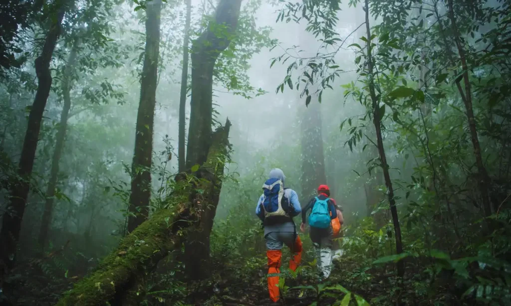
Many travelers assume that a “jungle tour” in Puerto Vallarta means a deep, remote rainforest expedition that requires multiple days. In reality, most jungle experiences here are half-day to full-day activities located in the foothills of the Sierra Madre mountains just south and east of the city. According to regional tourism data from the State of Jalisco, the Sierra Madre Occidental range forms the mountainous backdrop of Banderas Bay, creating a dense tropical environment within 30–60 minutes of downtown Puerto Vallarta. A one-day jungle tour typically includes adventure-based activities such as ATV riding, ziplining, waterfall hiking, or wildlife-focused eco experiences. Planning matters because conditions change quickly depending on the season, humidity, and rainfall. Afternoon storms are common during the summer months, and temperatures often exceed 30°C (86°F) with high humidity. In this guide, you will learn the differences between jungle tour types, realistic physical expectations, seasonal safety considerations, and how to choose an option that fits your time, fitness level, and travel style. What Does a “Jungle Tour” Mean in Puerto Vallarta? In Puerto Vallarta, a jungle tour usually takes place in the lower elevations of the Sierra Madre Occidental mountains, where tropical vegetation, riverbeds, and uneven dirt roads create a rugged landscape. This is not untouched rainforest. Instead, it is a semi-developed adventure zone with guided routes, established canopy parks, and designated off-road paths. Operators typically run activities from ranch-style bases or eco-parks located south of the city near areas like Boca de Tomatlán and El Jorullo. Common jungle tour types include: ATV / RZR tours, which follow dirt roads, riverbeds, and hillside tracks Zipline canopy parks, built across valleys and forested slopes Waterfall hikes, involving jungle trails and shallow river crossings Wildlife eco-tours, focused on birdwatching or regional plant life River swimming stops, often included during off-road tours It is important to clarify that this environment is not comparable to the Amazon basin. Trails are accessible within a short drive, and many routes are designed for tourism rather than remote exploration. Understanding this helps set realistic expectations and prevents disappointment or overestimation of difficulty. Quick Comparison: Types of Jungle Tours You Can Do in One Day Choosing the right jungle experience depends on fitness level, season, and group composition. Below is a comparison overview based on operator standards, regional climate patterns, and activity requirements commonly listed by licensed tour providers in Puerto Vallarta. Jungle Tour Comparison Table Tour Type Physical Level Duration Best Season Good for Families? Risk Level ATV / RZR Moderate 3–4 hrs Dry season Older teens Medium Zipline Canopy Moderate 3–5 hrs Year-round Yes Low–Medium Waterfall Hike Moderate 2–4 hrs Dry season Yes Medium Horseback Jungle Low–Moderate 2–3 hrs Year-round Yes Low Eco Wildlife Tour Low 3–4 hrs Year-round Yes Low Why this matters: Dry season (November–May) offers firmer terrain and lower rainfall. Rainy season (June–October) increases mud and river flow, especially for ATV and waterfall routes. Zipline tours often operate year-round but may pause during heavy lightning storms for safety reasons. This side-by-side view helps travelers avoid booking an activity that does not match their comfort level or travel group. ATV & Off-Road Jungle Tours: What to Expect ATV and RZR jungle tours are among the most physically engaging options available in Puerto Vallarta. Routes typically follow dirt roads, gravel paths, and shallow riverbeds within the Sierra Madre foothills. During the dry season, dust levels can be significant, especially on open hillside stretches. In contrast, rainy season conditions create muddy tracks and slippery inclines. According to Mexico’s National Meteorological Service, Puerto Vallarta receives most of its annual rainfall between June and October, which directly affects trail traction and water crossings. These tours require moderate physical engagement, including steering over uneven terrain and maintaining balance on rough surfaces. Individuals with back, neck, or joint conditions may find the vibration and impact uncomfortable. These are best for those who don’t mind getting dusty or muddy. They follow the rugged trails of the Sierra Madre. For renting a private boat in Puerto Vallarta, which often covers how to combine land and sea adventures. Helmets and safety briefings are standard with licensed operators, but participants should expect real off-road conditions rather than paved paths. Proper footwear and hydration are essential, particularly during warmer months when humidity remains high. Zipline & Canopy Parks: Are They Worth It? Zipline canopy tours in Puerto Vallarta operate in controlled environments built across forested valleys and hillsides. These parks follow international safety standards and typically include certified harness systems, helmet requirements, and trained staff at each platform. Weight limits vary by operator but often range between 45–120 kg (100–265 lbs). Age minimums are commonly set around 6–8 years old, depending on height and safety harness fit. Weather plays an important role. While ziplining can operate in light rain, lightning storms cause temporary suspensions for safety reasons. During peak summer months, tours often schedule earlier start times to reduce exposure to heat and afternoon rainfall. Expect a time commitment of approximately three to five hours, including transportation, equipment fitting, and safety orientation. For families seeking structured adventure with controlled risk levels, canopy parks are often considered one of the more predictable jungle activities available. Waterfall & River Jungle Hikes Waterfall hikes take visitors deeper into jungle trails that include natural terrain features such as rocks, shallow streams, and uneven slopes. Popular zones are located near Boca de Tomatlán and inland villages where rivers descend from the Sierra Madre. These hikes often include river crossings that are manageable during dry months but can become stronger after heavy rainfall. Local civil protection agencies in Jalisco regularly advise caution near rivers during storm season due to sudden increases in water flow. Participants should wear stable, closed-toe shoes and expect moderate humidity throughout the year. Individuals uncomfortable with wet terrain or uneven footing may find these hikes challenging. During the rainy season, trails can become muddy and slippery, increasing the risk of falls. Starting early in the morning reduces both heat exposure and the likelihood of encountering
Puerto Vallarta Hiking
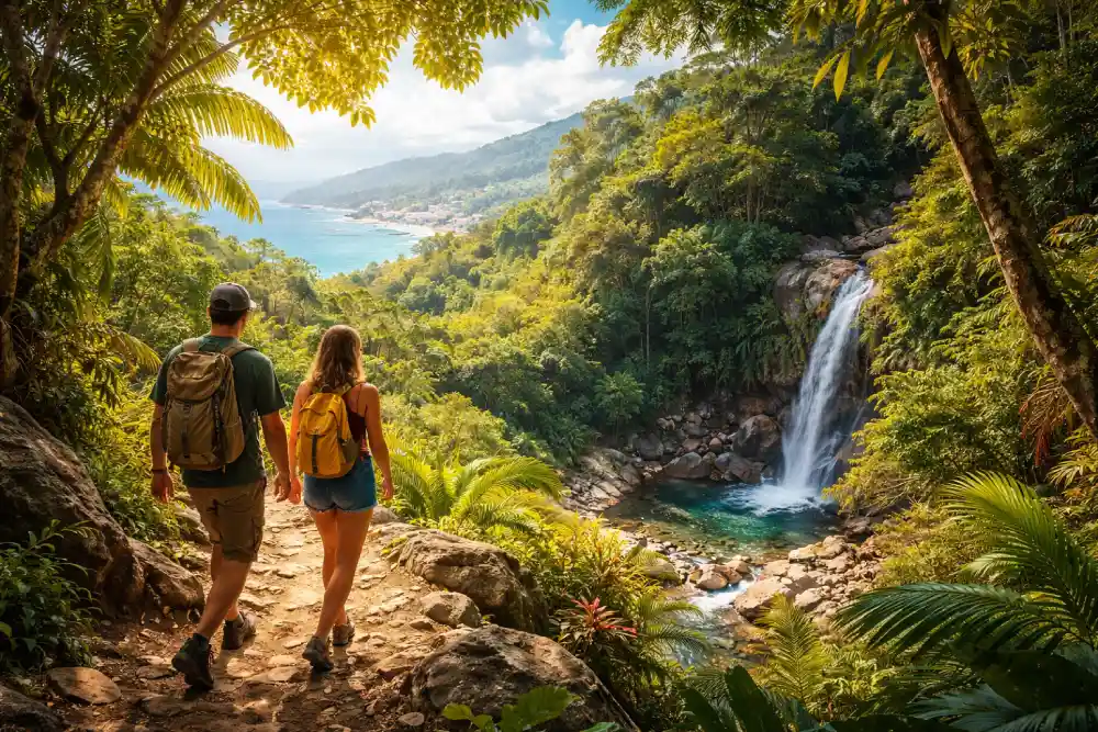
Many travelers arrive in Puerto Vallarta expecting quiet jungle paths, only to find that the most advertised trails are busier than anticipated. Popular routes like Boca de Tomatlán to Las Ánimas or Mirador de la Cruz are frequently shared across hotel brochures, tour desks, and social media. The result is predictable foot traffic, especially between late morning and mid-afternoon. So is there really “hidden” hiking here? The answer is yes, but it depends on timing, access to knowledge, and realistic expectations. What most tourists miss is not necessarily secret trails, but smarter approaches: starting earlier, continuing beyond common turnaround points, or choosing inland extensions instead of beachfront stops. This guide focuses on practical decision-making, trail difficulty, seasonal timing, safety considerations, and access logistics, so you can choose routes that match your ability while avoiding avoidable mistakes. What Makes a Trail “Hidden” in Puerto Vallarta? In Puerto Vallarta, a “hidden” trail rarely means undiscovered. Instead, it typically refers to routes that are not promoted heavily in resort materials or mass-market travel blogs. Many quieter trails begin near small communities such as El Nogalito or Quimixto, where signage is limited and entry points are easy to overlook without prior research. According to regional tourism resources from the State of Jalisco, much of the surrounding Sierra Madre terrain remains rural and lightly developed, which means infrastructure is minimal compared to national parks elsewhere in Mexico. Trails often require local orientation rather than clear trail markers. Crowd levels also depend heavily on timing. For example, Mirador de la Cruz may feel empty before 8:00 a.m., yet becomes busy by mid-morning. “Hidden” here often means understanding start times, seasonal patterns, and how far beyond the common stopping point most visitors actually go. Key Characteristics of Less-Crowded Trails Minimal signage or formal trailheads Access through small residential or rural areas Limited vendor presence along the route Early start required for lower foot traffic No tour buses or organized large groups Quick Comparison: Best Less-Crowded Hiking Trails in Puerto Vallarta Below is a practical overview of quieter hiking options based on terrain reports, seasonal access patterns, and local outdoor activity data from regional tourism and hiking communities. These trails are established routes but require better timing and preparation than heavily marketed paths. Hidden Trail Comparison Overview Trail Difficulty Duration Best Season Ends at Beach? Crowd Level Boca to Colomitos (early start) Moderate 1–2 hrs Nov–May Yes Low (early) Palo Maria Upper Falls Moderate 1.5–2 hrs Dec–May No Low El Nogalito Eco Trail Moderate 2–3 hrs Dry season No Very Low Mirador de la Cruz (sunrise) Moderate 30–45 min Year-round No Low (early) Quimixto Inland Trail Moderate 2–3 hrs Nov–May Yes Very Low Why this matters: November through May aligns with the dry season, when humidity drops and trail surfaces are more stable. Rainy season (roughly June through October) increases mud, slippery rock conditions, and sudden river swelling. Beach-ending trails often attract more traffic after 10:00 a.m. due to water taxi arrivals. Boca de Tomatlán to Colomitos (Done the Smart Way) The Boca de Tomatlán to Colomitos trail is widely known, yet many hikers unintentionally increase congestion by starting late in the morning. Most group tours and water taxis begin operating heavily after 9:30 a.m., which increases beach traffic. Starting between 7:00 and 8:00 a.m. significantly reduces crowd overlap and heat exposure. Whether you are planning a half-day snorkel trip or a sunset cruise, choosing the right boat rental in Puerto Vallarta is the first step toward an unforgettable vacation. Many hikers stop at Colomitos and return the same way, doubling foot traffic on narrow sections. However, continuing onward toward Las Ánimas or planning a coastal exit reduces backtracking. What Most Tourists Miss Early departures drastically change crowd levels Peak boat traffic increases shoreline congestion Round-trip hiking doubles fatigue and heat exposure For hikers combining inland activity with coastal relaxation, planning a one-way route and arranging a later departure from a beach area can reduce strain. Operators familiar with the coastline, including services departing from Marina Vallarta, sometimes coordinate returns for those who prefer not to retrace the entire route. This approach works best in dry-season months when trail conditions remain stable. Palo Maria Waterfall: The Upper Trail Most Visitors Skip Palo Maria Waterfall is frequently mentioned in travel forums, yet most visitors stop at the first cascade. The upper trail sections involve uneven rock scrambling and stream crossings that require steady footing. According to local outdoor groups and seasonal weather records from Jalisco’s civil protection authorities, rainfall between June and October increases the risk of slippery rock surfaces and fast-moving runoff. During heavy rain periods, upper sections can become hazardous due to unstable footing. Key Considerations Rock surfaces become slick during or after rainfall Water flow can increase quickly in storm conditions Proper footwear is necessary beyond the first waterfall The upper trail rewards hikers with fewer people and quieter pools, but it is not ideal for beginners or anyone uncomfortable with mild scrambling. Attempting this route during the peak rainy season should be reconsidered if storms are forecast. Checking weather reports on the day of the hike reduces unnecessary risk. El Nogalito Eco Trail: A Quiet Jungle Alternative El Nogalito offers a less commercialized hiking experience within the Sierra Madre foothills. Access begins through a small residential area, and signage is limited, which naturally reduces foot traffic. The trail includes several shallow river crossings that are manageable during dry months but become more challenging after heavy rain. Local environmental groups highlight that this area supports native vegetation and bird species, contributing to its quiet atmosphere. Who Should Avoid This Trail Hikers without proper footwear Anyone uncomfortable crossing shallow streams Visitors attempting the hike late in the afternoon Because the trail does not end at a major beach or restaurant area, it feels more remote. Cell reception can be inconsistent in deeper sections, so downloading offline maps in advance is helpful. This trail is best approached in the dry season, typically November through May, when river
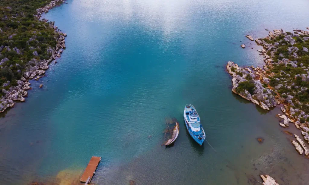
Why Coastal Destinations Are Best Experienced From the Water

Coastal destinations attract travelers because of their mix of scenery, culture, and natural beauty, but many visitors only experience them from land. Roads, beaches, and viewpoints show one side of the coast, yet they rarely capture its full character. Experiencing a coastline from the water offers a broader and more immersive perspective that land-based travel cannot match. From the sea, landscapes unfold gradually, revealing natural formations, marine life, and quiet stretches untouched by crowds. Water-based travel also changes the pace of a trip, encouraging slower movement and deeper appreciation of surroundings. Whether through a short cruise or a longer journey, being on the water transforms how travelers connect with coastal destinations, making the experience feel more complete, relaxed, and memorable than exploring solely from shore. At Palmara Charters, we specialize in these transformative moments, providing a gateway to the ocean’s most secluded treasures. The Unique Perspective You Get From the Water Viewing a coastline from the water reveals details that are often hidden or inaccessible from land. Cliffs, rock formations, and shoreline curves appear differently when approached from the sea, offering a wider sense of scale and natural design. From this angle, travelers also gain a clearer understanding of how towns, harbors, and natural features connect along the coast. Marine life such as birds, fish, and even larger sea animals, is more easily observed in their natural environment. These water-based vantage points create strong visual memories because they feel exclusive and immersive, allowing travelers to experience coastal beauty in a way that feels personal rather than crowded or rushed. Wellness and Mental Benefits of Being on the Water Time spent on the water often feels calmer than time spent on land, and there are clear reasons for this. The steady movement of waves and the open horizon create a sense of rhythm that encourages relaxation. Many travelers report feeling less tension and mental fatigue when surrounded by open water. Sea air is often associated with improved mood and clearer breathing, which contributes to a feeling of refreshment. Without traffic noise or crowded spaces, water-based travel feels quieter and more focused. This environment supports mindfulness and helps travelers disconnect from daily stress. Compared to busy land tours or packed attractions, being on the water allows for moments of stillness and reflection, making coastal trips feel more restorative and balanced. Freedom and Flexibility You Can Only Get From the Water One of the greatest advantages of experiencing coastal destinations from the water is the freedom it provides. Boats and yachts are not restricted by roads or fixed routes, allowing travelers to explore at their own pace. Unplanned stops at quiet beaches or scenic viewpoints are possible when conditions allow. This flexibility opens access to remote areas that are rarely visited by land travelers. Water travel also allows itineraries to change based on weather, mood, or interest, rather than rigid schedules. Travelers can spend more time in places they enjoy and move on easily from others. This sense of control over timing and movement creates a more personal experience, where exploration feels guided by curiosity rather than logistics. Coastal Wildlife and Marine Encounters From the Water The water provides a front-row view of coastal wildlife that land-based experiences often miss. Boats and charters move quietly through marine environments, increasing chances of seeing animals in their natural habitats. Dolphins frequently travel alongside vessels, seabirds rest on nearby rocks, and sea turtles surface in calm areas. These encounters feel more authentic because they happen without barriers or crowds. Observing wildlife from the water also highlights how closely coastal ecosystems are connected to the sea. Travelers gain a better understanding of the balance between land and marine life. These moments often become highlights of a trip, as they offer genuine connections with nature that feel spontaneous and unforced compared to structured land tours. Responsible wildlife viewing is essential, and following the Marine Life Viewing Guidelines ensures that your encounter with dolphins or turtles is safe for both you and the animals. Water-Based Adventures and Activities Coastal destinations offer a wide range of activities that are best accessed from the water. Snorkeling and swimming directly from a vessel allow travelers to reach clearer waters and less disturbed marine areas. Diving sites and reefs are often located away from shore, making boats essential for access. Water sports such as paddleboarding, jet skiing, and sailing add variety and excitement to coastal trips. Exploring sea caves, small islands, and underwater features is also easier and safer from a boat. These activities create a sense of exploration and engagement that land-based options cannot replicate. Being on the water turns the journey itself into part of the adventure, not just a means of reaching a destination. Cultural and Local Life Seen Better From the Sea Coastal culture often makes more sense when viewed from the water rather than from busy streets or crowded viewpoints. Many fishing villages, small harbors, and waterfront communities were built to face the sea first, not the road. Approaching these places by boat shows how daily life is shaped by tides, fishing routes, and marine traditions. From the water, travelers can see working docks, local boats, and shoreline homes that are rarely noticed from land. This perspective highlights traditional coastal lifestyles that depend on the ocean for food, income, and connection. Marine access adds depth to cultural understanding because it reflects how communities have lived for generations. Seeing coastal towns from the sea helps travelers appreciate the practical and cultural bond between people and the water. Why Boat and Yacht Experiences Are Ideal for Coastal Travel Boat and yacht experiences fit coastal travel naturally because they allow smooth movement between locations without the need for road transfers. Travelers can explore multiple areas in a single outing while staying in one comfortable setting. Privacy is another major advantage, as boats provide space away from crowds and fixed schedules. Yachts and charters offer shaded areas, seating, and onboard amenities that support longer exploration without fatigue, and you can explore
How to Dress on a Yacht: Style, Comfort, and Practical Tips

Dressing for a yacht is different from dressing for a beach day or a city outing, and that difference often catches travelers off guard. A yacht combines sun, sea breeze, movement, and social settings in one space, which means clothing needs to work harder. The right outfit keeps you comfortable while also fitting the relaxed but polished atmosphere most yachts have. Many people worry about overdressing or underdressing, especially if it’s their first time on the water. The goal is not fashion statements but ease, confidence, and practicality. At Palmara Charters, we want you to feel as good as you look from the moment you step onto our pristine decks. When you understand how conditions on a yacht affect clothing choices, it becomes much easier to pack outfits that feel appropriate from morning cruising to sunset drinks, without constantly needing to change or feel uncomfortable. What Makes Dressing for a Yacht Different From Regular Travel Wear Yacht dressing is shaped by the environment more than trends. Sun exposure is stronger on the water, and the breeze can shift quickly, especially once the yacht starts moving. Clothing needs to handle heat, airflow, and occasional splashes. Comfort is essential, but style still matters because yachts are social spaces where people relax, dine, and take photos. Safety is another factor many travelers overlook. Deck surfaces can be slippery, so clothing and footwear should allow stable movement. Fabrics that dry quickly and breathe well help prevent discomfort. Unlike city wear, yacht outfits should allow easy sitting, standing, and walking on uneven surfaces. This balance between comfort, appearance, and safety is what separates good yacht attire from regular vacation clothing. Daytime Yacht Attire: Casual and Comfortable Options Daytime on a yacht is usually relaxed, focused on cruising, sunbathing, swimming, and enjoying the scenery. Clothing during these hours should feel light, flexible, and easy to adjust as temperatures change. Day outfits are often casual, but they should still look put together. Overly heavy or restrictive clothing can become uncomfortable quickly. The goal is to stay cool while still feeling presentable if you move between deck areas, dining spaces, or shore stops. Choosing the right materials and layering options makes daytime dressing simple and practical without sacrificing personal style. Light, Breathable Fabrics for Warm Weather Lightweight fabrics are essential for daytime yacht wear. Linen and cotton allow airflow and help regulate body temperature under direct sun. Breathable clothing reduces overheating and stays comfortable even during longer cruises. UV-protective fabrics are also a smart choice, especially for guests spending extended time on deck. Loose-fitting shirts, airy dresses, and relaxed shorts work well because they move with the breeze instead of trapping heat. Avoid heavy denim or thick synthetic materials, as they can feel stiff and warm. The best daytime fabrics feel soft, dry quickly, and allow you to stay comfortable without constantly adjusting your outfit. Swimwear and Cover-Ups for Deck Lounging or Water Activities Swimwear is a central part of daytime yacht attire, but it should be styled thoughtfully. Swimsuits alone are best reserved for sunbathing or swimming. When moving around the yacht, a cover-up, light shirt, or casual wrap adds comfort and courtesy. Cover-ups also provide extra sun protection and help you feel more comfortable during meals or conversations. Practical designs that slip on easily work best, as guests often move between water and deck areas. Choosing neutral or classic colors helps swimwear blend easily with other daytime pieces, making outfit changes simple and stress-free. Footwear for Deck Safety and Comfort Footwear is one of the most important choices on a yacht. Deck surfaces can become slick, so shoes with soft, slip-resistant soles are ideal. Boat shoes, deck sandals, or lightweight slip-ons provide grip without marking the deck. Many yachts prefer guests to remove shoes entirely, especially in interior spaces, so footwear that is easy to take on and off is helpful. High heels and hard soles are not recommended, as they reduce stability and may damage surfaces. Comfortable, secure footwear allows you to move confidently without worrying about balance. Evening and Sunset Yacht Outfits As the day transitions into evening, temperatures often cool and the atmosphere becomes more social. Evening yacht attire is usually more refined than daytime wear but still relaxed. Light layers are useful, as the breeze can feel cooler once the sun sets. Evening outfits often need to shift from casual lounging to dining or socializing without a full wardrobe change. Choosing versatile pieces makes this transition easier. Comfort remains important, but evening attire typically looks more polished, reflecting the quieter, more intimate setting onboard. Yacht Party Dress Codes: From Casual Cruises to Elegant Events Yacht parties vary widely, from informal daytime gatherings to structured evening events. Understanding the tone of the event helps guide outfit choices. Dress codes are usually implied rather than stated, so balance is key. Clothing should feel appropriate for social interaction while remaining practical for the marine setting. Bright colors, light fabrics, and relaxed silhouettes often work well, but formality increases as events move into the evening. Planning outfits around the type of gathering prevents discomfort and helps guests feel confident throughout the event. Casual Day Parties: Relaxed but Stylish Day parties on a yacht are easygoing and social. Outfits should feel comfortable while still showing some intention. Light dresses, relaxed shirts, and breathable sets work well. Nautical-inspired colors like white, navy, and soft pastels fit naturally into the setting. Accessories should be minimal and secure. The focus is on enjoying the atmosphere rather than standing out. Comfortable clothing allows guests to move freely, sit, and socialize without worrying about heat or restriction. Sophisticated Evening Parties: Semi-Formal Attire Evening yacht parties tend to lean toward smart casual or semi-formal styles. Lightweight dresses, linen shirts, and tailored trousers are common choices. Fabrics should remain breathable, but cuts are usually more refined. Layering is helpful, as evenings can cool quickly. Footwear should remain practical, but slightly dressier options are appropriate. The goal is to look polished without feeling stiff,